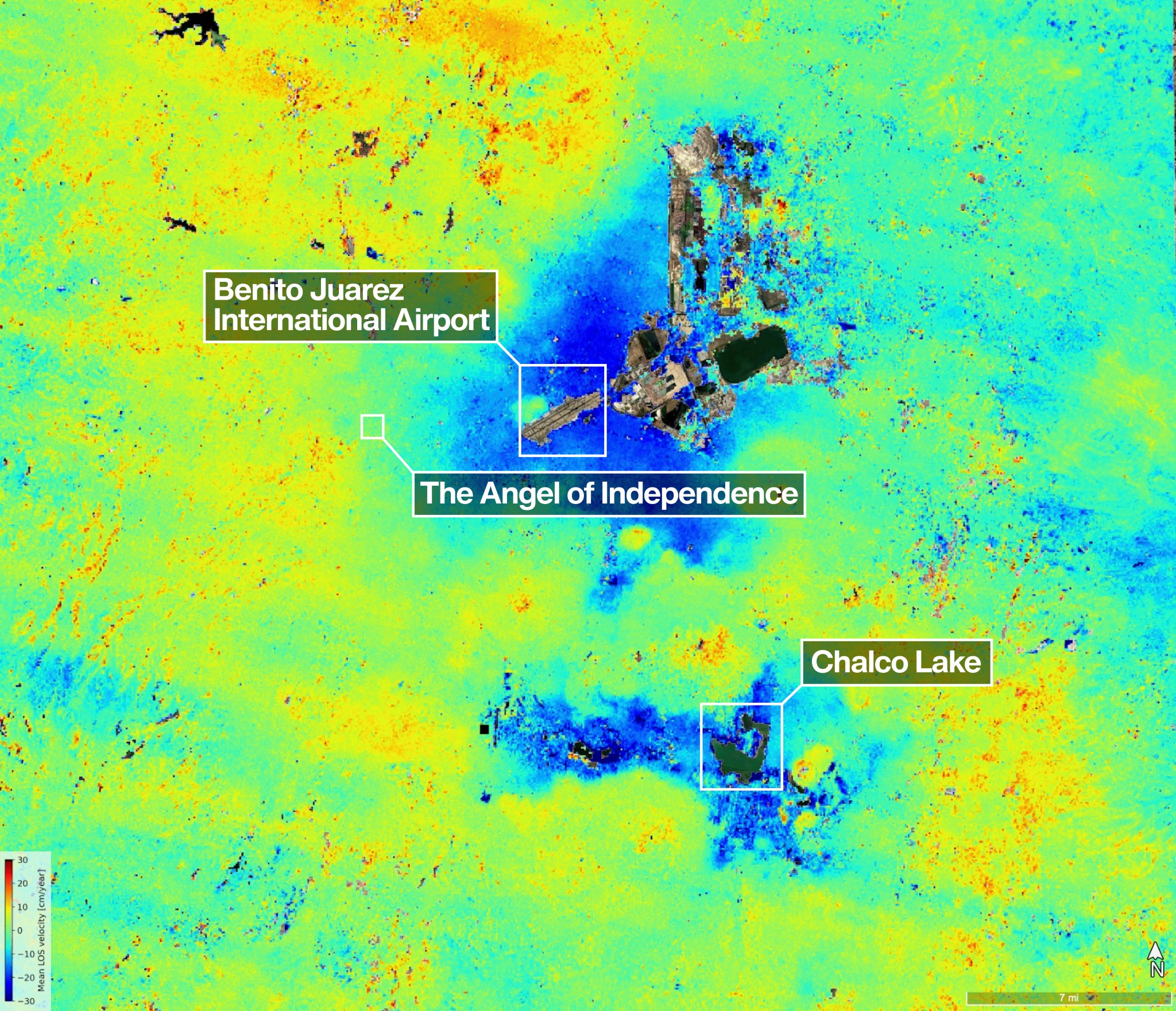
 One of the most powerful radar systems ever launched into space has mapped the ground moving beneath one of fastest subsiding capitals in the world: Mexico City. The findings show how quickly and reliably the NISAR (NASA-ISRO Synthetic Aperture Radar) satellite can track real-time changes across Earths surface from orbit, unhindered by clouds or vegetation []
US-Indian Space Mission Maps Extreme Subsidence in Mexico City
NASA Breaking news - 29 Apr 2026 22:23
One of the most powerful radar systems ever launched into space has mapped the ground moving beneath one of fastest subsiding capitals in the world: Mexico City. The findings show how quickly and reliably the NISAR (NASA-ISRO Synthetic Aperture Radar) satellite can track real-time changes across Earths surface from orbit, unhindered by clouds or vegetation []
Share this Article
Recommended